
Sallie Barber Mine
The Sallie Barber Mine Trail is a leisurely 2.8-mile hiking trail offering an easy-going outdoor adventure suitable for hikers of all skill levels. This scenic trail winds through a forested landscape with trailside remnants of the Breckenridge mining era, including old mining equipment, providing a glimpse into the region’s rich history. With its gentle terrain and historical allure, the Sallie Barber Mine Trail offers an enjoyable outing for nature enthusiasts and history buffs, making it a must-visit destination for those seeking a relaxed exploration of Breckenridge’s past and natural beauty.
Difficulty: Moderate
Distance: 2.8 miles
Elevation Gain: 400 feet
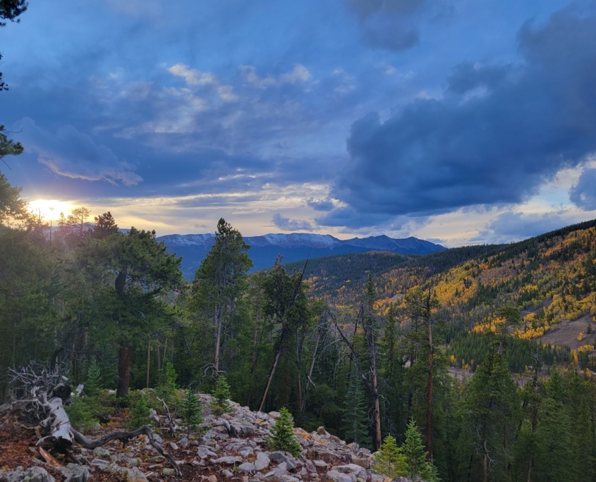
 Gold Hill
Gold Hill is a 2.9-mile hiking trail located in the heart of Summit County, offering an easy and rewarding outdoor experience. As you meander along this picturesque path, you’ll be treated to breathtaking views of the Upper Blue River Valley, with Lake Dillon in the distance- quite the backdrop! Gold Hill truly comes alive during the fall season, as vibrant aspen groves line the trail, providing fall colors for hikers to admire. Whether you’re seeking captivating views, a tranquil stroll, or the enchanting beauty of autumn foliage, Gold Hill promises a memorable and accessible journey through Colorado’s beauty.
Difficulty: Easy
Distance: 2.9 miles
Elevation Gain: 528 feet
Simone S. via Alltrails.com
Iowa Hill
Iowa Hill is a brief yet enriching 0.7-mile interpretive trail. Despite its short length, this trail offers an immersive journey through time, with informative signs detailing the history of the mining era and showcasing various mining equipment remnants along the way. A highlight of the trail is the well-preserved boarding house, which provides a glimpse into the lives of miners who once called this area home. For those seeking a quick but educational adventure amidst the splendor of fall leaves, Iowa Hill is the perfect choice, offering a condensed yet captivating exploration of Breckenridge’s mining history and seasonal beauty.
Difficulty: Moderate
Distance: 0.7 mile
Elevation Gain: 187 feet
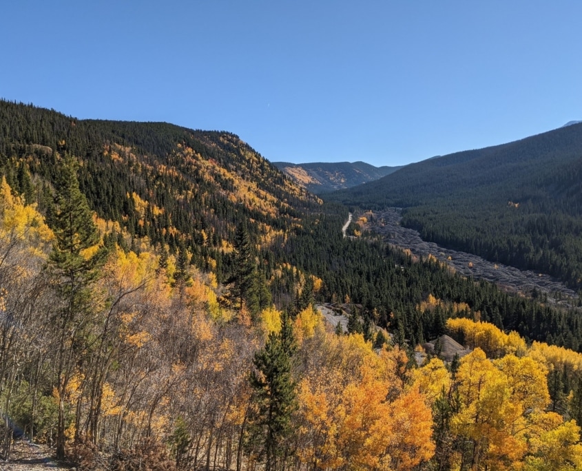
Photo by Heraclio Medina via Alltrails.com
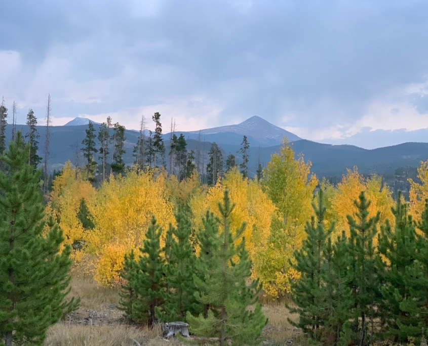
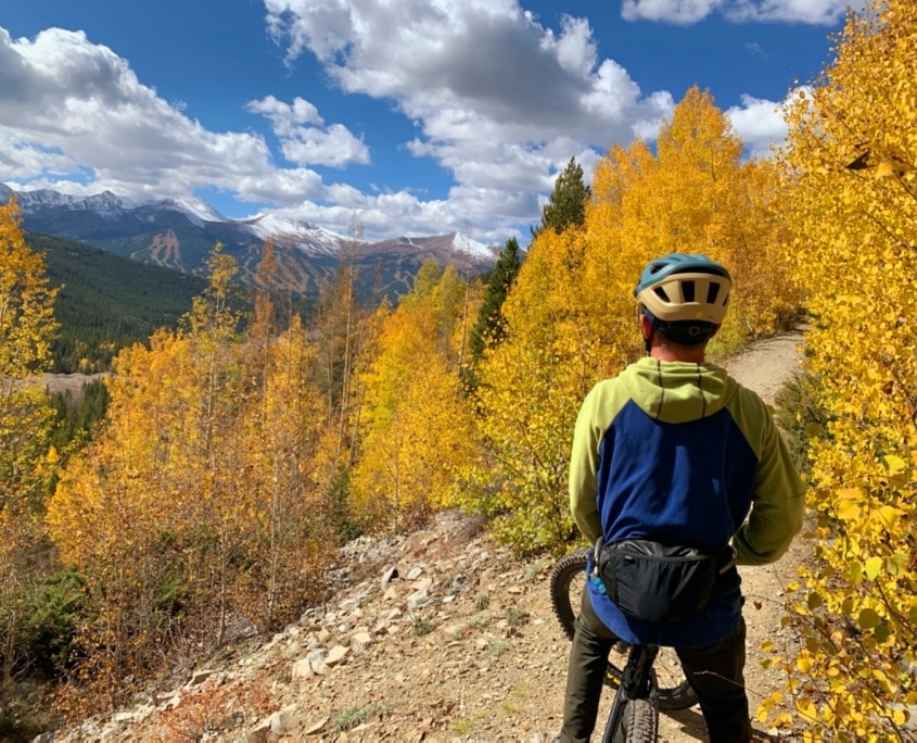
Prospect Hill
The Prospect Hill Trail is an option for those seeking a bit more challenge, spanning 6.1 miles and featuring a moderately challenging elevation gain of over 1,000 feet. As you ascend this scenic path, you’ll be treated to breathtaking vistas of the Tenmile Range, offering a panoramic view that’s particularly breathtaking during the fall season when vibrant aspen trees start to turn. It’s worth noting that this trail is popular among mountain bikers, so hikers should remain mindful of their surroundings. For those in search of a hiking adventure that combines a bit of a workout with stunning views and a splash of autumn colors, the Prospect Hill Trail is an excellent choice.
Difficulty: Moderate
Distance: 6.1 miles
Elevation Gain: 1,092 feet
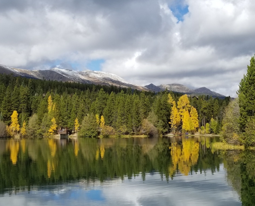
Sawmill Reservoir
Sawmill Reservoir is our favorite in-town hike, perfect for adventurers of all skill levels. Covering a short distance of 1.3 miles with only 200 feet of elevation gain, this trail offers a gentle and enjoyable experience. Along the tranquil Sawmill Creek, the path leads you to a hidden treasure: a surprisingly beautiful lake framed by a backdrop of Breckenridge Ski Resort. Despite its proximity to the heart of Breckenridge, the Sawmill Reservoir trail retains a sense of being tucked away in the wilderness, making it a favorite among locals and visitors alike. Whether seeking a leisurely stroll or a quick escape to tranquility, this trail promises a delightful and rejuvenating outing.
Difficulty: Easy
Distance: 1.3 miles
Elevation Gain: 232 feet
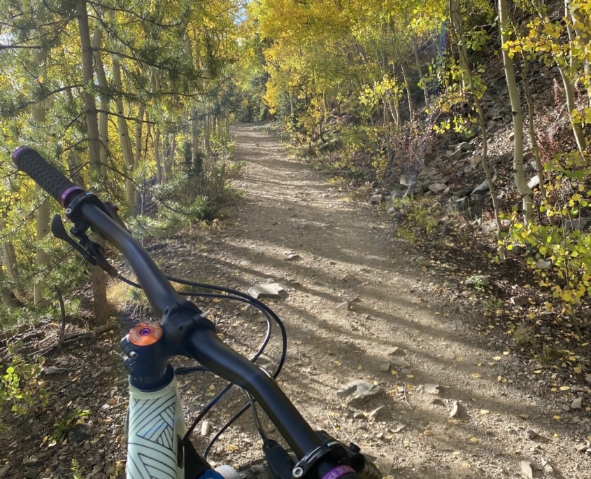
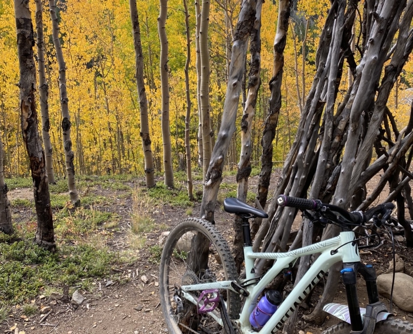
Aspen Alley
Aspen Alley is a 1.3-mile single-track mountain bike trail in the scenic Boreas Pass area. With an elevation gain of 15 feet and a descent of 519 feet, it offers an exhilarating ride for outdoor enthusiasts. True to its name, Aspen Alley is renowned for its views of vibrant aspen groves, especially during the leaf-peeping season, creating a picturesque ride for bikers. Additionally, the trail treats riders to panoramic vistas of the Tenmile Range, making it a must-visit destination for mountain bikers who like to enjoy the view while they ride.
Difficulty: Blue
Distance: 1.3 miles
Elevation Gain: 15′ up, 519′ down
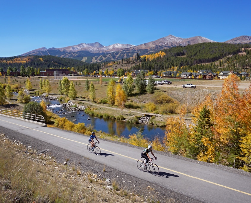
Blue River Trail
The Blue River Trail is a leisurely 3-mile single-track route that meanders alongside the Blue River. Perfect for riders seeking a relaxed and picturesque biking experience, this trail offers a tranquil journey through its scenic surroundings. With its easy terrain and proximity to the river, the Blue River Trail is an ideal choice for cyclists of all skill levels looking to immerse themselves in nature’s beauty while enjoying a gentle ride. During the fall season, the trail becomes even more exciting as it transforms into a corridor of vibrant foliage, making it an especially captivating destination for those eager to witness the breathtaking colors of autumn.
Difficulty: Green
Distance: 3.1 miles
Elevation Gain: 86′ up, 137′ down
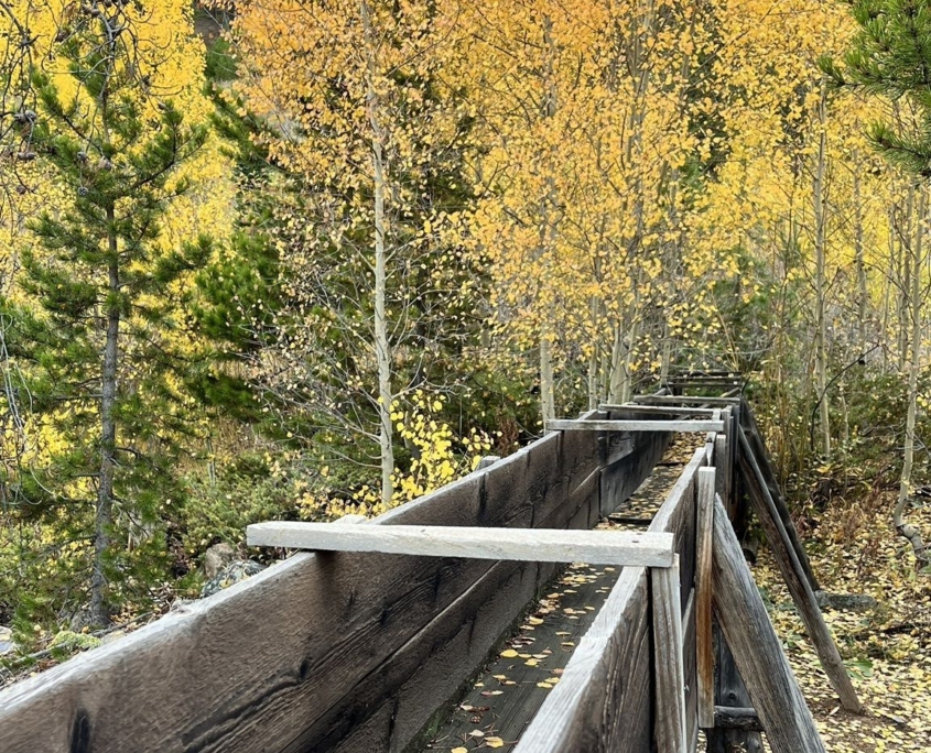
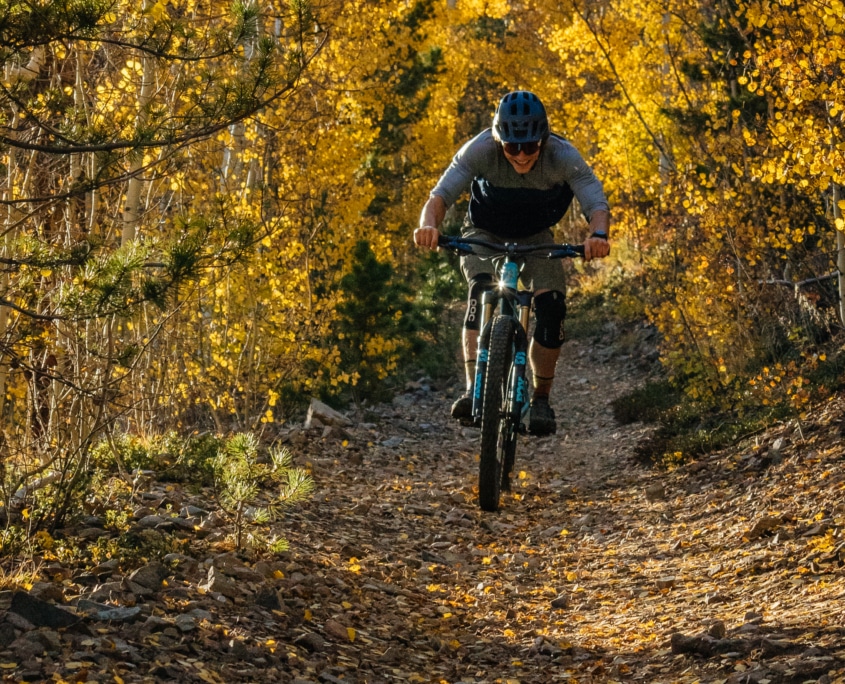
Flumes Loop
The Breckenridge Flumes Loop is an ideal choice for beginner mountain bikers seeking a scenic adventure in the heart of Breckenridge. This 6.5-mile loop offers a manageable elevation gain and descent of 494 and 493 feet, respectively, ensuring a gentle introduction to mountain biking. The trail meanders through Lower Flume Trail, Mike’s Trail, Middle Flume Trail, and Upper Flume Trail, showcasing the area’s natural beauty and diverse landscapes. However, it’s worth noting that both Mike’s Trail and the southern end of the Upper Flume Trail present steeper, more challenging climbs that may test the skills of novice riders. Nevertheless, the Breckenridge Flumes Loop offers a well-rounded biking experience, making it a great choice for those looking to build their confidence while enjoying the stunning surroundings of Breckenridge.
Difficulty: Blue
Distance: 6.5 miles
Elevation Gain: 494′ up, 493′ down
Baker’s Tank
Baker’s Tank Trail, a blue-rated route, spans 2.8 miles with an average grade of 6%. To embark on this journey, begin at the Boreas Pass winter trailhead parking lot and either pedal or drive along Boreas Pass Road until you reach the iconic Baker’s Tank. The trail commences on the western side of the tank, where an initially steep climb from Boreas Pass Road soon gives way to a more gentle ascent after the first 500 feet. Over the next 0.9 miles, steadily climb while relishing the striking views of Breckenridge and the surrounding landscapes. Enjoy a 0.8-mile descent that leads to a junction with the Valdero Trail. From there, continue heading due west, taking in the breathtaking fall foliage and the ever-present panorama of Breckenridge. Prepare for another short climb as you continue your adventure along the route. Baker’s Tank Trail promises an exciting biking experience and a visual feast of fall colors and stunning Breckenridge vistas.
Difficulty: Blue
Distance: 6 miles
Elevation Gain: 687′ up, 687′ down
Peaks Trail
The Peaks Trail is a challenging yet rewarding intermediate to difficult trail that connects the towns of Breckenridge and Frisco, spanning a distance of 8 miles. This rolling forested trail offers a diverse single-track experience, winding through the lush woods and showcasing the natural beauty of the area. It’s a popular destination for both hikers and bikers, so be prepared for some trail traffic. As you navigate this route, you’ll encounter a mix of terrain and enjoy the serenity of the forest, making the Peaks Trail a must-visit for outdoor enthusiasts looking for a challenging adventure and a connection between two picturesque mountain communities.
Difficulty: Blue/Black
Distance: 8 miles
Elevation Gain: 1,227′ up, 328′ down
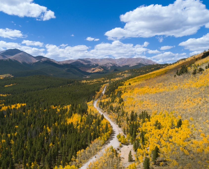
Drone image of Boreas Pass in Breckenridge, CO
Boreas Pass
Boreas Pass Road, originally known as Breckenridge Pass, is a historical route with roots tracing back to the 1860s when it served as a vital pathway to access gold mines in the area. Whether your journey begins in Breckenridge or the Como, this scenic drive promises views and a relatively quick trip, typically taking about an hour to cover its just under 20-mile span. The road is suitable for low-clearance 2WD cars, although some sections may get a bit bumpy. For the most part, it offers an easy, high-alpine drive experience, meandering through stunning landscapes and reaching a peak elevation of 11,481 feet above sea level. One of its notable attractions is the opportunity to view the breathtaking fall foliage, making it a local favorite during the mid-to-late September leaf-peeping season. Whether you’re a history enthusiast, a nature lover, or simply seeking an enjoyable mountain drive, Boreas Pass Road offers a delightful and memorable journey.
Route: Breckenridge to Como
Mileage: 19.8 miles
Duration: 1 hour
Distance from Breckenridge: 0 miles
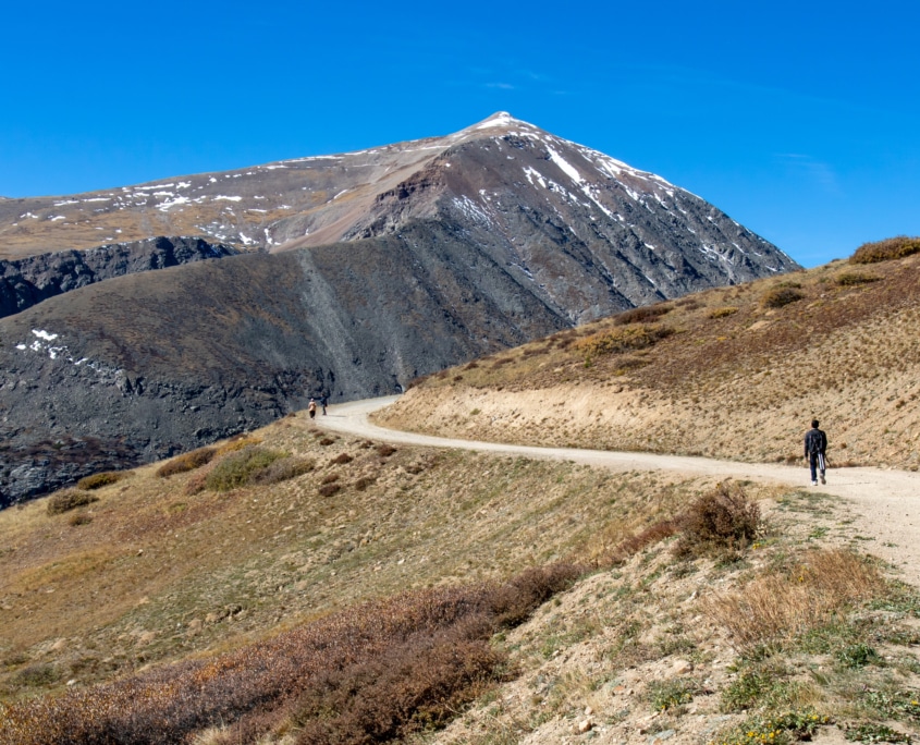
Tourists hiking on the Hoosier Pass on fall
Hoosier Pass
Hoosier Pass is a mountain pass that connects the towns of Breckenridge and Alma while traversing the Continental Divide at an elevation of 11,539 feet above sea level. Serving as the natural boundary between the Tenmile and Mosquito mountain ranges, this pass offers a journey through the heart of Colorado’s high country. The road is fully paved, making it accessible to all types of vehicles. Covering a distance of approximately 17 miles, the drive typically takes around 30 minutes, allowing for a quick yet rewarding mountain excursion. Keep a keen eye out for moose as you pass through the Blue River area. For those seeking an extended leaf-peeping adventure, consider combining your Hoosier Pass journey with a drive along Boreas Pass Road from Breckenridge to Como, creating a larger loop that showcases the area’s stunning fall foliage.
Route: Breckenridge to Alma
Mileage: 16.9 miles
Duration: 30 minutes
Distance from Breckenridge: 0 miles
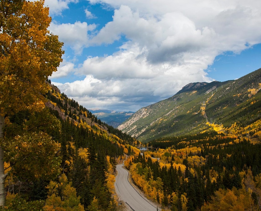
Photo by peaktopeakmiata.org
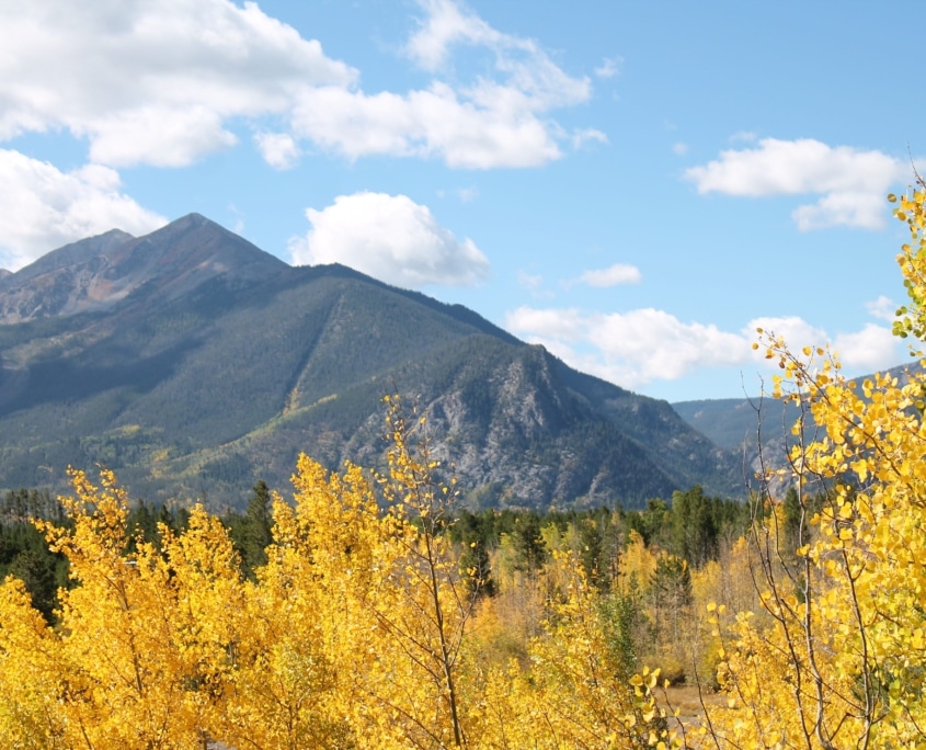
Guanella Pass
Guanella Pass Scenic Byway is a 24-mile mountain journey that weaves its way through the pristine beauty of two national forests, offering a picturesque drive from I-70 to US 285 in Colorado. This scenic route commences in the historic town of Georgetown, within the Arapaho National Forest, and gradually ascends to an elevation of 11,669 feet over the course of 12 miles. Upon reaching the summit, the byway transitions into the Pike National Forest, treating travelers to a different yet equally mesmerizing terrain. Along this journey, you’ll be immersed in aspen trees, providing a front-row seat to the spectacular transformation of vibrant green leaves into a dazzling display of golden fall colors. The drive typically takes about an hour. Guanella Pass Scenic Byway is a must-visit destination that promises an unforgettable experience.
Route: Georgetown to Grant
Mileage: 23.8 miles
Duration: 1 hour
Distance from Breckenridge: 36.9 miles
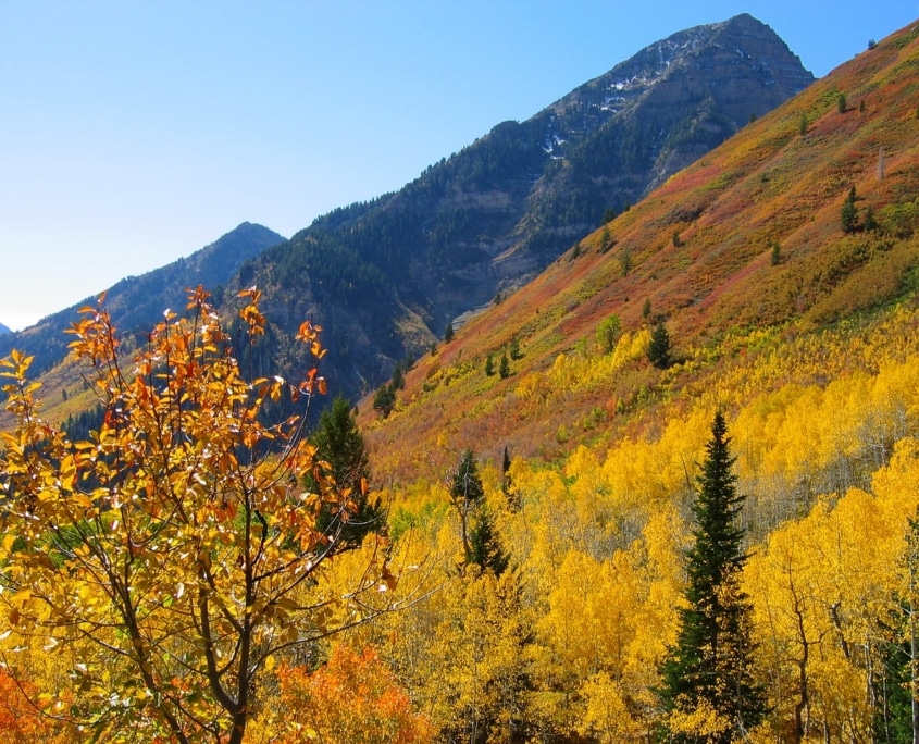
Photo by thetimberline.com
Independence Pass
Independence Pass, an iconic mountain pass in the heart of the Central Rockies, offers a journey that connects Twin Lakes to Aspen. Although a bit further from Breckenridge, this scenic byway takes you on an unforgettable adventure through a range of landscapes, showcasing the breathtaking beauty of Colorado’s high country. The road is fully paved and accessible to all vehicles. However, be prepared for a thrilling and winding mountain pass with steep inclines not for the faint of heart. As you ascend, the pass reaches a towering elevation of 12,095 feet, providing awe-inspiring panoramic views of the surrounding peaks and valleys. Consider taking the time to stop in Aspen, a town renowned for its namesake aspen trees. Enjoy a leisurely lunch, stroll through the charming streets, or simply bask in the serenity of the surrounding wilderness.
Route: Twin Lakes to Aspen
Mileage: 36.9 miles
Duration: 1 hour 15 minutes
Distance from Breckenridge: 60 miles
Summit County Loop
The Summit County loop is a picturesque journey through Summit County, offering a diverse range of scenic landscapes and adventure opportunities. Begin your drive by heading to Swan Mountain Road, and stop at Sapphire Point for views of the Tenmile Range and Lake Dillon. Extend your exploration by traveling along Highway 6 to Keystone and even venture further into the charming town of Montezuma. On your return trip via Dillon Dam Road to Frisco, you’ll be treated to a display of colorful aspen trees that line the road. Conclude your fall drive with a visit to Prosit in Frisco, where you can enjoy a tasty bratwurst paired with a refreshing German beer, creating your personal Oktoberfest experience!
Route: Loop Lake Dillon (Breckenridge, over Swan Mountain, return via Dillon Dam Road)
Mileage: 30.3 miles
Duration: 1 hour
Distance from Breckenridge: 0 miles
 https://bgvowners.com/wp-content/uploads/2023/03/680x400_Indoor2.jpg
400
680
Becca Clark
http://blog.breckenridgegrandvacations.com/wp-content/uploads/2024/01/bgv_logo.png
Becca Clark2025-04-30 10:00:102025-05-05 13:28:22Top 10 Kid-Friendly Indoor Activities
https://bgvowners.com/wp-content/uploads/2023/03/680x400_Indoor2.jpg
400
680
Becca Clark
http://blog.breckenridgegrandvacations.com/wp-content/uploads/2024/01/bgv_logo.png
Becca Clark2025-04-30 10:00:102025-05-05 13:28:22Top 10 Kid-Friendly Indoor Activities https://bgvowners.com/wp-content/uploads/2024/04/680x400_spring2.jpg
400
680
Becca Clark
http://blog.breckenridgegrandvacations.com/wp-content/uploads/2024/01/bgv_logo.png
Becca Clark2025-03-23 15:05:432025-03-24 12:35:36Getaway Guide to Spring in Breckenridge
https://bgvowners.com/wp-content/uploads/2024/04/680x400_spring2.jpg
400
680
Becca Clark
http://blog.breckenridgegrandvacations.com/wp-content/uploads/2024/01/bgv_logo.png
Becca Clark2025-03-23 15:05:432025-03-24 12:35:36Getaway Guide to Spring in Breckenridge https://bgvowners.com/wp-content/uploads/2025/03/680x400_spring.jpg
400
680
Becca Clark
http://blog.breckenridgegrandvacations.com/wp-content/uploads/2024/01/bgv_logo.png
Becca Clark2025-03-18 13:33:322025-03-18 14:55:10Spring Skiing: Late Season Operations
https://bgvowners.com/wp-content/uploads/2025/03/680x400_spring.jpg
400
680
Becca Clark
http://blog.breckenridgegrandvacations.com/wp-content/uploads/2024/01/bgv_logo.png
Becca Clark2025-03-18 13:33:322025-03-18 14:55:10Spring Skiing: Late Season Operations https://bgvowners.com/wp-content/uploads/2023/09/sweater_680x400.jpg
400
680
Becca Clark
http://blog.breckenridgegrandvacations.com/wp-content/uploads/2024/01/bgv_logo.png
Becca Clark2024-10-02 09:59:382024-10-02 12:53:23Sweater Weather Sips
https://bgvowners.com/wp-content/uploads/2023/09/sweater_680x400.jpg
400
680
Becca Clark
http://blog.breckenridgegrandvacations.com/wp-content/uploads/2024/01/bgv_logo.png
Becca Clark2024-10-02 09:59:382024-10-02 12:53:23Sweater Weather Sips https://bgvowners.com/wp-content/uploads/2022/10/680x400_GhostTour-scaled.jpg
1505
2560
Becca Clark
http://blog.breckenridgegrandvacations.com/wp-content/uploads/2024/01/bgv_logo.png
Becca Clark2024-09-25 09:30:022024-10-01 13:04:14Breckenridge’s Haunted History Tours
https://bgvowners.com/wp-content/uploads/2022/10/680x400_GhostTour-scaled.jpg
1505
2560
Becca Clark
http://blog.breckenridgegrandvacations.com/wp-content/uploads/2024/01/bgv_logo.png
Becca Clark2024-09-25 09:30:022024-10-01 13:04:14Breckenridge’s Haunted History Tours https://bgvowners.com/wp-content/uploads/2024/09/680x400_breckbliss.jpg
400
680
Breckenridge Grand Vacations
http://blog.breckenridgegrandvacations.com/wp-content/uploads/2024/01/bgv_logo.png
Breckenridge Grand Vacations2024-09-23 00:00:532024-09-23 14:12:09Breckenridge Bliss: 10 Paths to Relaxation and Wellness
https://bgvowners.com/wp-content/uploads/2024/09/680x400_breckbliss.jpg
400
680
Breckenridge Grand Vacations
http://blog.breckenridgegrandvacations.com/wp-content/uploads/2024/01/bgv_logo.png
Breckenridge Grand Vacations2024-09-23 00:00:532024-09-23 14:12:09Breckenridge Bliss: 10 Paths to Relaxation and Wellness https://bgvowners.com/wp-content/uploads/2023/09/680x400_spooky.jpg
400
680
Becca Clark
http://blog.breckenridgegrandvacations.com/wp-content/uploads/2024/01/bgv_logo.png
Becca Clark2024-09-20 12:16:092024-09-20 15:06:08Seven Spooky Ways to Celebrate Halloween in Summit
https://bgvowners.com/wp-content/uploads/2023/09/680x400_spooky.jpg
400
680
Becca Clark
http://blog.breckenridgegrandvacations.com/wp-content/uploads/2024/01/bgv_logo.png
Becca Clark2024-09-20 12:16:092024-09-20 15:06:08Seven Spooky Ways to Celebrate Halloween in Summit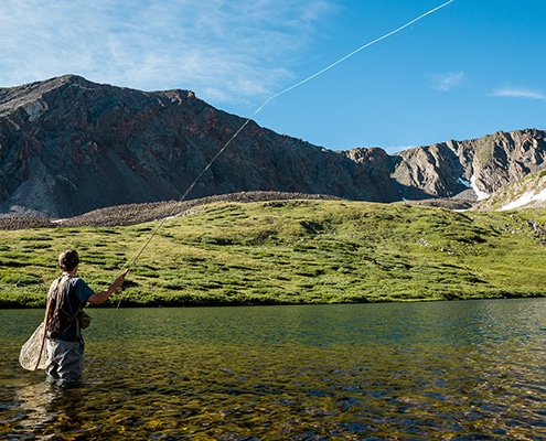 https://bgvowners.com/wp-content/uploads/2017/05/20190806_BTO_FlyFish_0097-1-copy.jpg
400
680
Breckenridge Grand Vacations
http://blog.breckenridgegrandvacations.com/wp-content/uploads/2024/01/bgv_logo.png
Breckenridge Grand Vacations2024-09-15 16:02:422024-09-18 10:26:58Breckenridge Fly Fishing Adventures
https://bgvowners.com/wp-content/uploads/2017/05/20190806_BTO_FlyFish_0097-1-copy.jpg
400
680
Breckenridge Grand Vacations
http://blog.breckenridgegrandvacations.com/wp-content/uploads/2024/01/bgv_logo.png
Breckenridge Grand Vacations2024-09-15 16:02:422024-09-18 10:26:58Breckenridge Fly Fishing Adventures https://bgvowners.com/wp-content/uploads/2024/09/680x400_sportsbars.jpg
400
680
Becca Clark
http://blog.breckenridgegrandvacations.com/wp-content/uploads/2024/01/bgv_logo.png
Becca Clark2024-09-11 16:06:472024-09-11 16:07:31Where To Catch The Game: Sports Bars in Breckenridge
https://bgvowners.com/wp-content/uploads/2024/09/680x400_sportsbars.jpg
400
680
Becca Clark
http://blog.breckenridgegrandvacations.com/wp-content/uploads/2024/01/bgv_logo.png
Becca Clark2024-09-11 16:06:472024-09-11 16:07:31Where To Catch The Game: Sports Bars in Breckenridge